
Chukchi Peninsula
Easternmost point of continental Asia, near Alaska.

Vaija · CC BY-SA 4.0
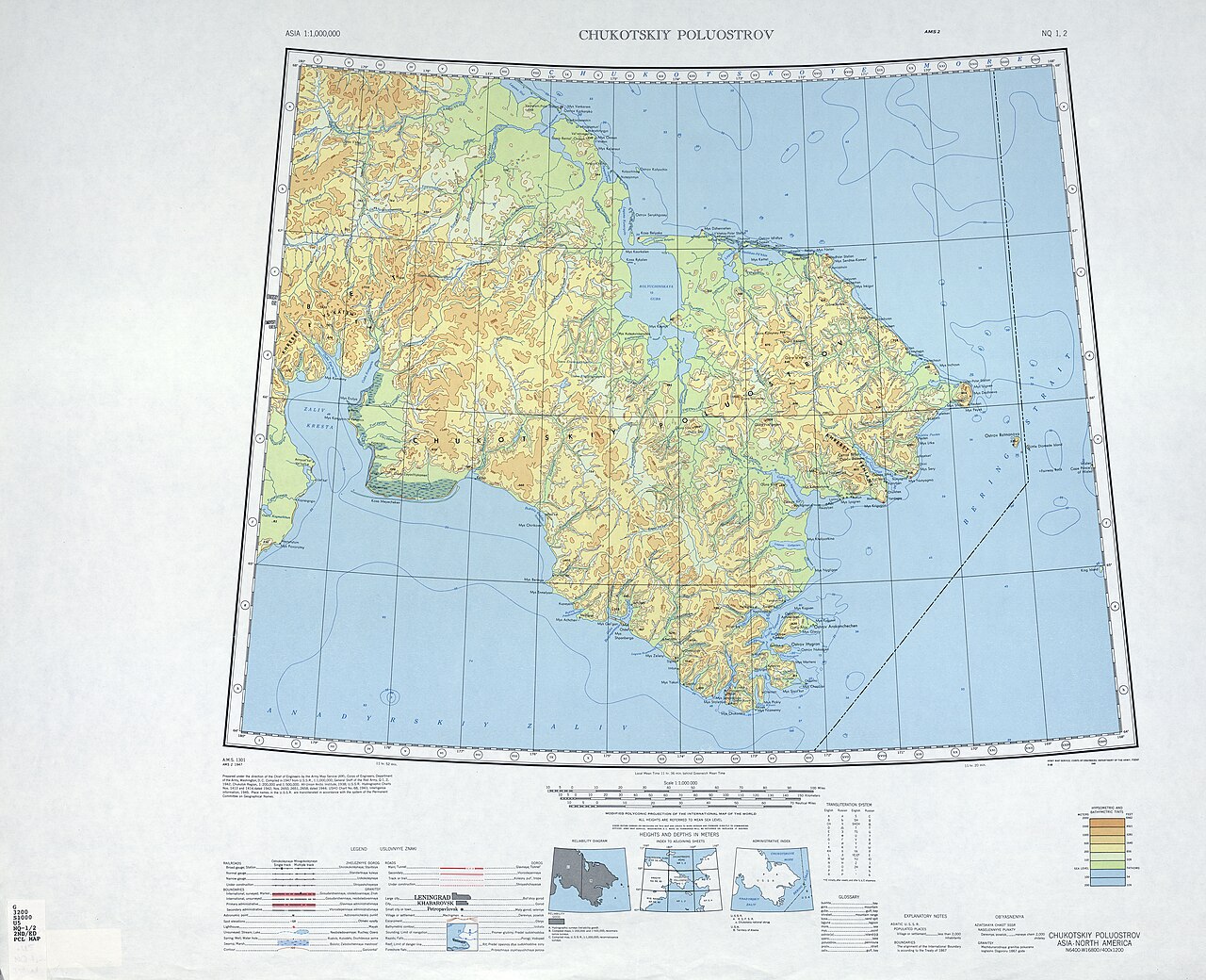
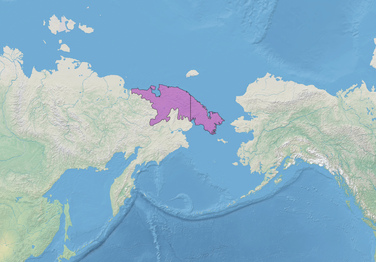
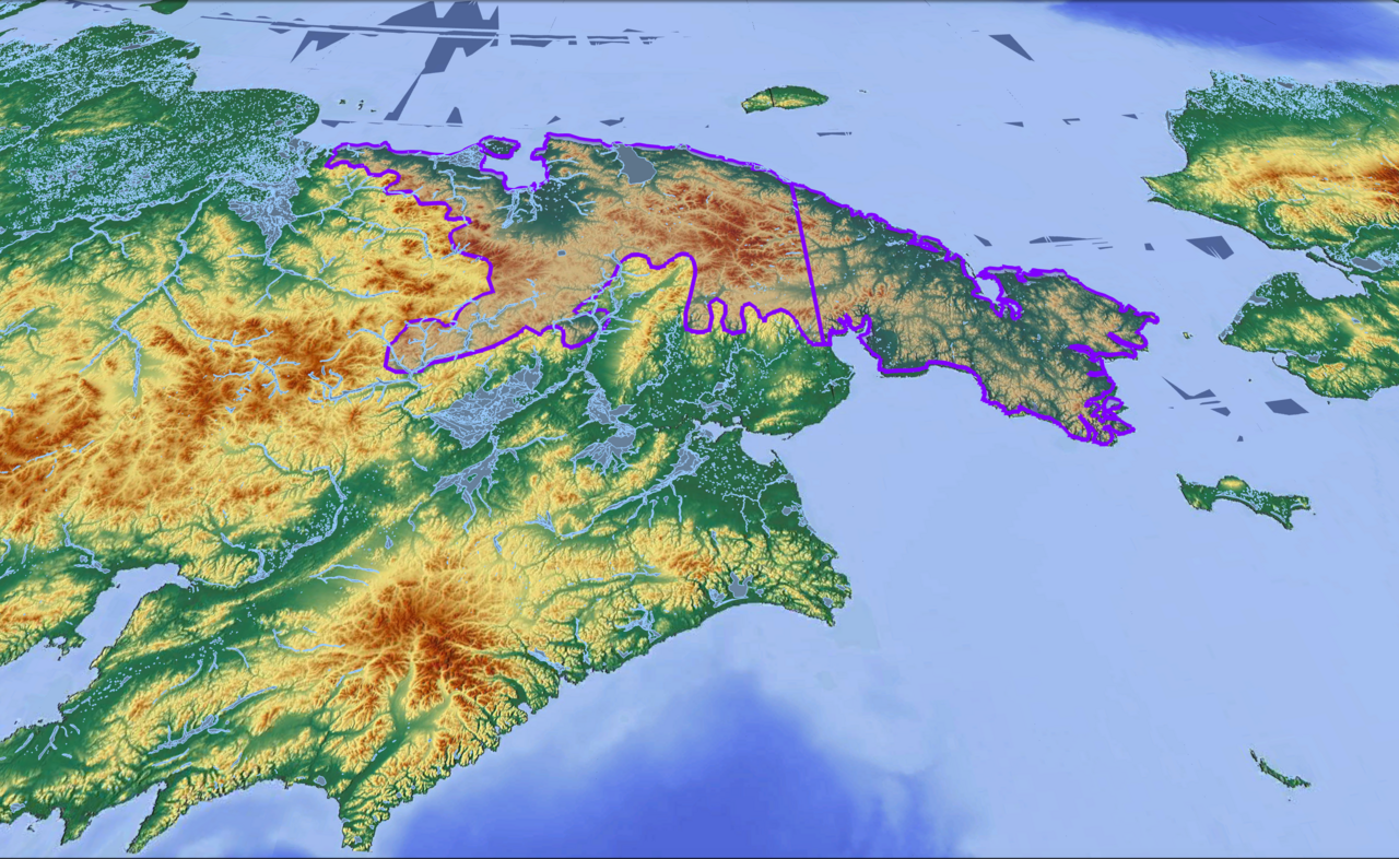
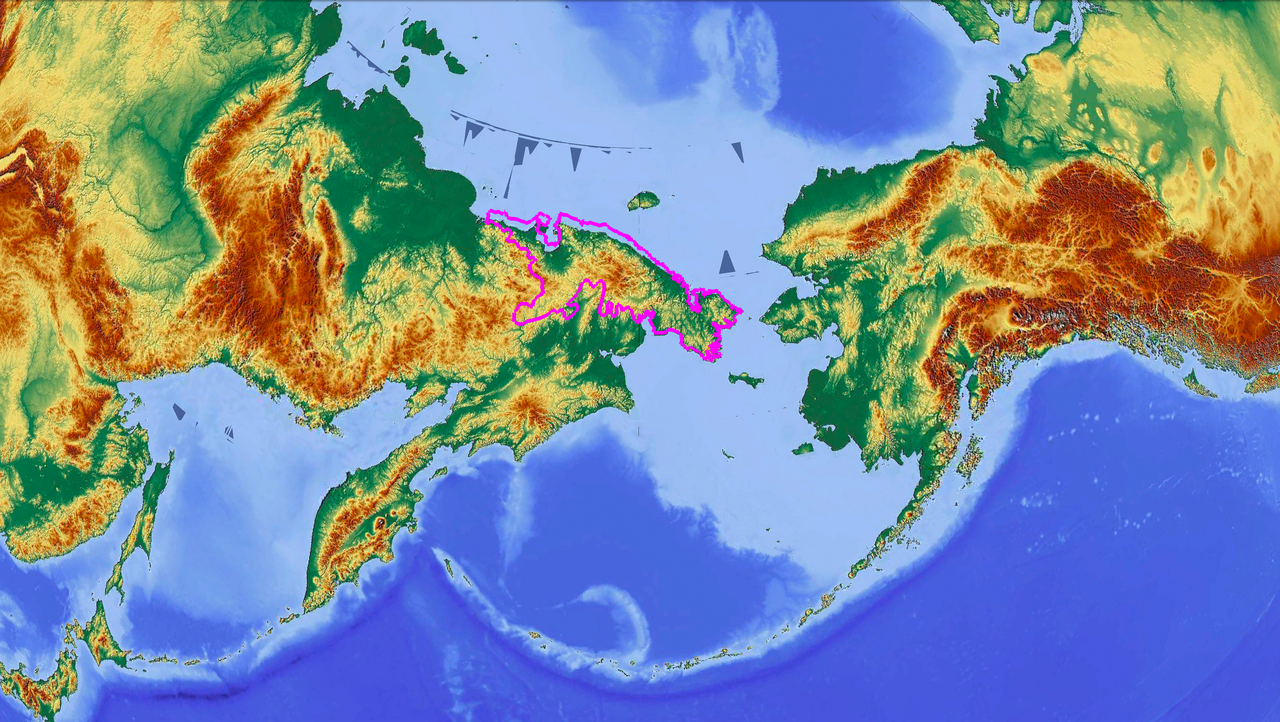
The peninsula is bounded by the Chukchi Sea to the north, the Bering Sea to the south, and the Bering Strait to the east, where at its easternmost point it is only about 60 km from the Seward Peninsula in Alaska, representing the smallest distance between the land masses of Eurasia and North America.
- easternmost_point
- Cape Dezhnev near Uelen
- part_of
- Chukotka Autonomous Okrug of Russia
- bordering_seas
- Chukchi Sea, Bering Sea, Bering Strait
- minimum_distance_to_North_America
- about 60 km (37 mi)
Lore & Background
The Chukchi Peninsula is traditionally the home of tribes of the indigenous peoples of Siberia as well as some Russian settlers. Industries on the peninsula include mining (tin, lead, zinc, gold, and coal), hunting and trapping, reindeer raising, and fishing.
Reader's Guide
The Chukchi Peninsula holds significance as the easternmost extremity of continental Asia, marking the closest land connection between Eurasia and North America at only about 60 km across the Bering Strait. The peninsula's economy, based on mining, reindeer raising, and fishing, reflects its remote Arctic environment. Lawrence Island further underscore the region's role as a crossroads between Russia and Alaska.
Did You Know?
- Its eastern end is at Cape Dezhnev near the village of Uelen.
- At its easternmost point, the peninsula is only about 60 km from the Seward Peninsula in Alaska.
- The peninsula lies along the Northern Sea Route, or Northeast Passage.
- Industries on the peninsula include mining (tin, lead, zinc, gold, and coal), hunting and trapping, reindeer raising, and fishing.
Defining the Peninsula: Etymology and Taxonomy
The very word "peninsula" carries a poetic image in its Latin roots, combining paene, meaning "almost," with insula, meaning "island." This etymology captures the essential character of the landform: a stretch of territory that is nearly, but not quite, an island, tethered to the mainland by a narrow connection while being surrounded on most sides by water. The surrounding waters are typically understood to form a continuous body, though they do not need to carry a specific name. Beyond the basic definition, the category encompasses a range of related features—headlands, capes, island promontories, bills, points, and spits—each representing a different degree of prominence. A point, for instance, is a tapering projection into water regarded as less significant than a cape. Even a river carving through an extremely tight meander can be described as creating a "peninsula" within its nearly closed loop of water. In English, the plural can be rendered as either peninsulas or, less frequently, peninsulae, reflecting the term's classical heritage.
A Global Atlas of Projections
Peninsulas appear on every inhabited continent, creating a remarkable diversity of coastal landforms. In Africa, the Horn of Africa projects into the Guardafui Channel as the continent's easternmost extremity, encompassing Djibouti, Eritrea, Ethiopia, and Somalia, while smaller features like the Lekki Peninsula in Nigeria and Cap-Vert in Senegal dot the western coast. Antarctica hosts its own cluster, including the Antarctic, Edward VII, Fletcher, Fowler, and Martin peninsulas. Asia offers extraordinary variety: China's Liaodong and Shandong, Japan's numerous projections across Hokkaido, Honshū, and Kyūshū, and the entire Korean landmass. Southeast Asia contributes the Camau, Irawaddy, and Sihanouk peninsulas, while the Deccan and Arabian stand as the defining features of South and Southwest Asia respectively. Europe and North America complete the picture, with Canada's Labrador and Belize's Placencia among many others.
Peninsulas as Continental Identity
Several peninsulas are so central to their region that they effectively define the identity of an entire landmass. The Deccan stands as the singular and largest geographical feature shaping the Indian subcontinent, while the Arabian Peninsula holds the same distinction for Southwest Asia. In West Asia, the Anatolian Peninsula is identified as the sole and most prominent cape in that part of the world. The Iberian Peninsula, which takes in mainland Portugal and Spain along with Andorra, Gibraltar, and a sliver of southern France, serves as the defining geographical feature of the Iberian region. Similarly, the Apennine Peninsula shapes Italy's character. Perhaps most strikingly, Europe is occasionally viewed as one vast peninsula projecting from Eurasia, which would make it among the largest in the world and the sole one granted the designation of a full continent—a status rooted more in convention than in hard science. The Korean landmass, too, is entirely a peninsula, bordered by the East Sea and Yellow Sea with the Korea Strait linking them.
Borders, Disputes, and Shifting Geographies
The political and physical realities of peninsulas often generate complex situations. The Bakassi Peninsula in Cameroon is noted as being disputed with Nigeria, illustrating how these landforms can become flashpoints for territorial conflict. The Peloponnese in Greece presents a fascinating case: it is now technically an island rather than a peninsula, a transformation brought about by the construction of the Corinth Canal. The Balkan Peninsula raises a different kind of controversy—its natural borders do not align with the technical definition of a peninsula, leading modern geographers to reject the very concept of a "Balkan Peninsula." Meanwhile, some places are peninsulas in ways that might surprise: Hong Kong is described as a peninsula in its entirety, and Wales is similarly identified as one. Even within well-known regions, classification can shift, as the Peloponnese's status change demonstrates. These examples reveal that the boundary between peninsula, island, and mainland is not always as clear as the Latin etymology might suggest.
Gallery

Frequently Asked Questions
Who is Chukchi Peninsula?
Chukchi Peninsula (also called the Chukotka or Chukotski Peninsula) is the easternmost tip of continental Asia, lying in Russia's Chukotka Autonomous Okrug at roughly 66° N, 172° W. Its far end, Cape Dezhnev near the small settlement of Uelen, marks the point where the Asian landmass stretches closest to North America.
What are Chukchi Peninsula's powers/role?
Its defining role is serving as the geographic hinge between Eurasia and North America, sitting just about 60 km (37 miles) from Alaska's Seward Peninsula across the Bering Strait. It is flanked by the Chukchi Sea to the north and the Bering Sea to the south, with the rugged Chukotka Mountains running through its interior.
How does Chukchi Peninsula's story end?
The peninsula's arc concludes at Cape Dezhnev, where the land tapers to its easternmost point and the gap to Alaska shrinks to its minimum of roughly 60 km. Beyond that tip there is no more continental Asia—only the open waters of the Bering Strait separating it from the North American landmass.
Why is Chukchi Peninsula important?
It holds the distinction of being the closest point between the continents of Asia and North America, making it a critical reference in geography, navigation, and the history of exploration. Its position at the junction of the Chukchi Sea, Bering Sea, and Bering Strait also gives it strategic and ecological significance.
Where does Chukchi Peninsula appear in the canon?
It is listed as entry 1-24 in the Peninsulas And Isthmuses series, representing the far eastern reach of the Russian Far East within the Chukotka Autonomous Okrug. On the broader world map it occupies the narrow junction where the Arctic and Pacific ocean basins nearly meet.
More in Peninsulas And Isthmuses 1-24
Related in Peninsulas And Isthmuses
Links follow this subject's own source article.
Spotted an error? Know more?
This is a living reference — every entry is fact-audited, and reader corrections feed straight into our audit queue. Suggest an edit · See this site's audit record