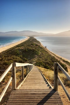
Kra Isthmus
Narrowest part of the Malay Peninsula in Thailand.

Alfred John Loftus · Public domain
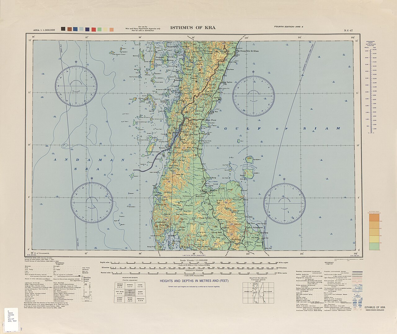
The Kra Isthmus, also called the Isthmus of Kra, is the narrowest part of the Malay Peninsula, located in Southern Thailand. Its western portion belongs to Ranong province and its eastern portion to Chumphon province. At its narrowest point, between the cities of Kra Buri and Chumphon, the coastal distance between the Andaman Sea and the Gulf of Thailand is only 44 km (27 mi). The isthmus marks the boundary between two sections of the mountain chain running from Tibet through the Malay peninsula, with the southern part being the Phuket Range, a continuation of the Tenasserim Hills.
- location
- Southern Thailand (Ranong and Chumphon provinces)
- narrowest_width
- 44 km (27 mi)
- ecoregion
- Tenasserim–South Thailand semi-evergreen rain forests
- dominant_trees
- Dipterocarps
- mountain_boundary
- Between Phuket Range and Tenasserim Hills
Lore & Background
The Kra Isthmus is the narrowest part of the Malay Peninsula, with a coastal distance of only 44 km between the Andaman Sea and the Gulf of Thailand. It lies in the Tenasserim–South Thailand semi-evergreen rain forests ecoregion, where dipterocarps are the dominant trees. The isthmus also marks the boundary between two sections of the mountain chain that runs from Tibet through the Malay peninsula: the southern Phuket Range, which continues the Tenasserim Hills, extends northwards for over 400 km beyond the Three Pagodas Pass.
Reader's Guide
The Kra Isthmus is significant for its geography as the narrowest point of the Malay Peninsula, making it a strategic location for proposed canal projects. The Thai Canal, also called the Kra Canal, is a long-standing proposal to join the Gulf of Thailand with the Andaman Sea, which would shortcut voyages from India to China and avoid the Strait of Malacca. Various routes have been proposed, with the northernmost route championed by Edward O'Riley and Henry Wise, and reported to the British Parliament in 1859 by Consul Robert Schomburk. The isthmus also played a role in the Pacific War: on 8 December 1941 local time, the Imperial Japanese Army landed in Songkhla, invading Thailand, and then moved south towards Perlis and Penang as part of the Malayan campaign. Because of the International Date Line, this occurred hours before the attack on Pearl Harbor, making it the first major action of the Pacific War.
Did You Know?
- At its narrowest point, between Kra Buri and Chumphon, the coastal distance between the Andaman Sea and the Gulf of Thailand is only 44 km (27 mi).
- The Phuket Range, south of the isthmus, extends northwards for over 400 km (250 mi) beyond the Three Pagodas Pass.
- On 8 December 1941 local time, the Imperial Japanese Army landed in Songkhla, invading Thailand—hours before the Pearl Harbor attack due to the International Date Line, making it the first major action of the Pacific War.
- The Thai Canal proposal was reported to the British Parliament in 1859 by Consul Robert Schomburk from Bangkok.
- Dipterocarps are the dominant trees in the Tenasserim–South Thailand semi-evergreen rain forests ecoregion.
Geography & the Mountain Divide
The Kra Isthmus represents the tightest pinch point along the entire Malay Peninsula, a geographic feature that has shaped trade routes and military strategy for centuries. Situated in Southern Thailand, the isthmus is split administratively between Ranong province on its western flank and Chumphon province on the eastern side. At the narrowest stretch, the coastal gap separating the Andaman Sea from the Gulf of Thailand measures a mere 44 kilometres (27 miles), measured between the Thai towns of Kra Buri and Chumphon. Beyond its role as a geographic bottleneck, the isthmus serves as a critical dividing line within a vast mountain chain that traces its path from the Tibetan plateau all the way down through the Malay Peninsula. The segment south of the isthmus is known as the Phuket Range, which functions as a direct continuation of the Tenasserim Hills. This mountain system extends more than 400 kilometres (250 miles) northward past the Three Pagodas Pass, linking the Kra region to the broader topography of mainland Southeast Asia.
Ecology & the Semi-Evergreen Forest
The Kra Isthmus falls within the Tenasserim–South Thailand semi-evergreen rain forests ecoregion, a biogeographic zone that stretches across the narrow land bridge connecting the two great water bodies of the region. This ecoregion is characterised by a distinctive vegetation profile in which dipterocarps—the towering, resin-producing trees of the family Dipterocarpaceae—dominate the canopy and define the overall structure of the forest. These trees, with their enormous buttressed trunks and vast crowns, create a layered understory that supports a rich web of fauna and flora adapted to the semi-evergreen conditions. The presence of these dominant species shapes everything from soil composition to the microclimate beneath the canopy, making dipterocarps the ecological backbone of the isthmus. The semi-evergreen nature of the forest means that while the region experiences a dry season, the trees do not shed their foliage entirely, maintaining a relatively constant green cover year-round. This ecological character distinguishes the Kra Isthmus from the more tropical rainforest zones found further south along the peninsula, giving the area a unique environmental identity within the broader Southeast Asian landscape.
The Pacific War's First Strike
The Kra Isthmus region holds a remarkable place in military history as the site of what is widely regarded as the opening blow of the Pacific War. On 8 December 1941, local time, the Imperial Japanese Army made a landing at Songkhla, launching an invasion of Thailand. Because of the International Date Line, this amphibious operation actually took place several hours before the 7 December attack on Pearl Harbor in Hawaii time, making it the first major military action of the entire Pacific conflict. The Japanese advance through the isthmus was not an isolated event but a strategic corridor operation: forces pushed southward through the narrow land bridge toward Perlis and Penang, feeding directly into the broader Malayan campaign. That campaign ultimately culminated in the fall of Singapore. The geographic narrowness of the Kra Isthmus made it a natural highway for ground forces moving between the Indian Ocean and Pacific theatres, and the Japanese exploited this corridor with devastating speed, turning a 44-kilometre strip of land into one of the most consequential military corridors of the twentieth century.
The Dream of the Thai Canal
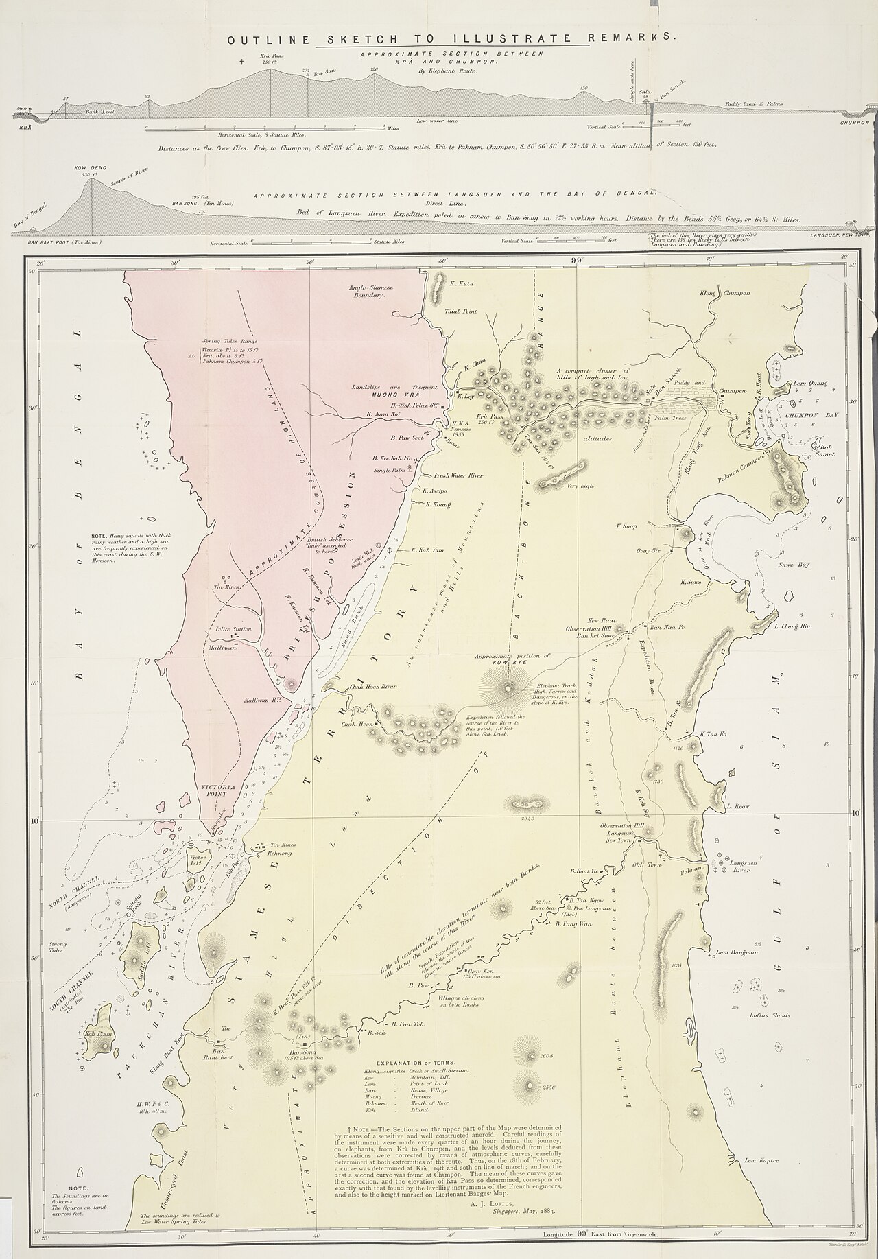
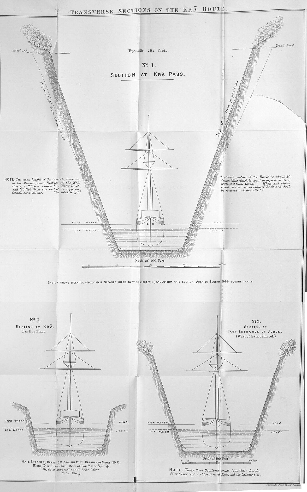
Long before modern engineering could make it feasible, the idea of cutting a waterway across the Kra Isthmus captured the imagination of colonial officials and maritime strategists. Known variously as the Thai Canal, the proposal aimed to link the Gulf of Thailand directly with the Andaman Sea, offering ships a dramatic shortcut between India and China while bypassing the lengthy and congested Strait of Malacca. Multiple routes were studied over the decades, but the northernmost option attracted particular attention. This route was championed by Edward O'Riley, a government official serving in Burma, and by Henry Wise in England. The concept gained formal political traction when Consul Robert Schomburk, stationed in Bangkok, presented a report on the canal to the British Parliament in 1859, elevating the discussion from speculative geography to serious policy debate. The writer Loftus later recounted a proposed crossing, indicating that the idea continued to circulate among travellers and officials well into the following decades. Despite its strategic appeal, the canal never materialised, leaving the Kra Isthmus as a narrow strip of land rather than an artificial waterway.
Gallery
Frequently Asked Questions
What is the Kra Isthmus?
The Kra Isthmus is the narrowest stretch of land on the Malay Peninsula, sitting in Southern Thailand where the Andaman Sea and the Gulf of Thailand draw closest together. It straddles Ranong province on the western side and Chumphon province on the eastern side.
How wide is the Kra Isthmus at its tightest point?
Between the towns of Kra Buri and Chumphon, the coastal gap between the two seas is only 44 km (roughly 27 mi). This makes it the constricted 'waist' of the entire Malay landmass.
What mountain boundary does the Kra Isthmus mark?
The isthmus sits at the dividing line between two segments of the great mountain chain that runs from Tibet down through the Malay Peninsula. South of the isthmus the range becomes the Phuket Range, a southern extension of the Tenasserim Hills.
What ecosystem surrounds the Kra Isthmus?
The area falls within the Tenasserim–South Thailand semi-evergreen rain forest ecoregion. Dipterocarp trees dominate the canopy throughout this tropical forest zone.
Why is the Kra Isthmus geographically significant?
Because it is the thinnest land bridge of the Malay Peninsula, it has long been the prime candidate for canal proposals that would link the Andaman Sea directly to the Gulf of Thailand. Its 44-km width makes it the most practical spot for such a waterway.
More in Peninsulas And Isthmuses 1-24
Spotted an error? Know more?
This is a living reference — every entry is fact-audited, and reader corrections feed straight into our audit queue. Suggest an edit · See this site's audit record