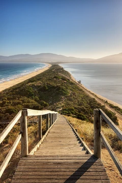
Kii Peninsula
Southernmost point of Honshū, typhoon-prone coastal town.

via Wikipedia: Kushimoto, Wakayama · see source
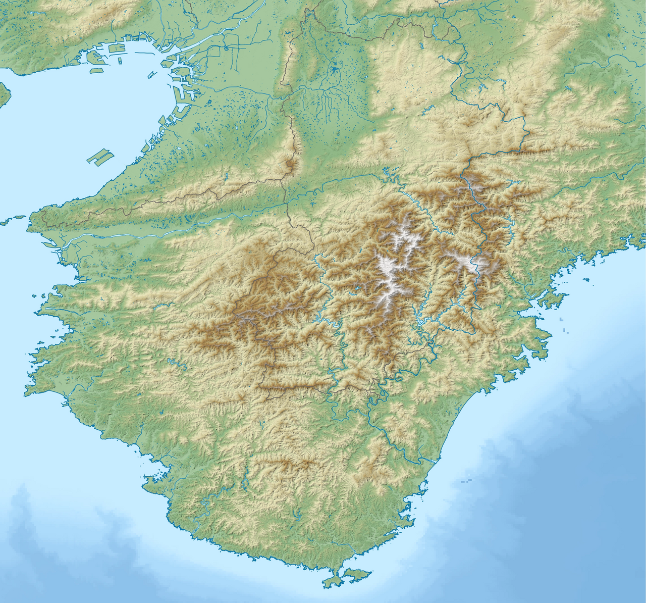
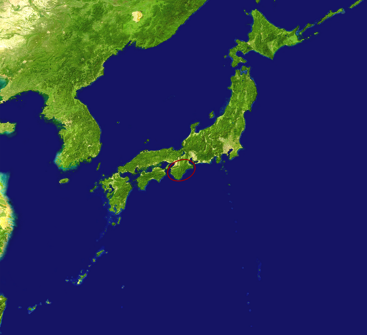
Kushimoto is a coastal town located in Higashimuro District, Wakayama Prefecture, Japan. It has the distinction of being the southernmost point of Japan's main island, Honshū, located at the southernmost tip of the Kii Peninsula. The urban area sits on the isthmus connecting Cape Shionomisaki with the mainland. As of 30 November 2021, the town had an estimated population of 15,192 in 8354 households and a population density of 110 persons per km2. The total area of the town is 135.67 square kilometres (52.38 sq mi).
- Area type
- Major peninsula on Honshū
Verified Timeline
Lore & Background
Kushimoto's history includes early encounters with the outside world. In 1791, US captains John Kendrick of the Lady Washington and William Douglas of the Grace visited Kushimoto, hoping to open a trading relationship with Japan. They did not receive a warm reception; news was sent to Wakayama Castle, which sent troops, but Kendrick and Douglas had departed two days before the troops arrived. The result was largely symbolic for the United States, but for Japan it resulted in a new system of alarms and coastal patrols, increasing Japan's isolation under sakoku. On September 16, 1890, the Ertuğrul incident occurred, in which an Imperial Ottoman Navy frigate on a goodwill visit to Japan floundered in a typhoon off of Kushimoto with great loss of life. Kushimoto village was established on April 1, 1889, and elevated to town status on November 12, 1907. The town grew through mergers, annexing Fujihashi in 1924, Arita, Shiono-Misaki, Tanami, and Wabuka in 1955, and Oshima in 1958. On April 1, 2005, Kushimoto merged with the town of Koza and became part of Higashimuro District.
Reader's Guide
Kushimoto is famous as the 'Typhoon Ginza' (after Ginza in Tokyo), due to its exposure to typhoons and the moist winds of the Kuroshio Current in summer. The climate is humid subtropical (Köppen Cfa), with an average annual temperature of 17.5 °C and average annual rainfall of 2515 mm. The wettest month was September 1929 with 846.5 millimetres, and the heaviest daily rainfall was 420.7 millimetres on 17 October 1939. The town was the epicenter of the Great Nankai earthquake, a magnitude 8.0 earthquake on December 21, 1946, which triggered a tsunami that enveloped the central part of town. Most of the Fujihashi neighborhood was destroyed but has since been rebuilt. On September 26, 1959, the Isewan Typhoon hit Kushimoto directly, killing 5,000 people and becoming the deadliest typhoon in modern Japan. Parts of the coastal area are within Yoshino-Kumano National Park and include the Hashiguiiwa Rocks, a National Natural Monument. The island of Kii Oshima is connected by the Kushimoto Ohashi Bridge, completed in September 1999. Local attractions include the Turkish Memorial and Museum, commemorating the Ertuğrul incident, and the United States Friendship Museum, commemorating the 1791 visit of the Lady Washington and Grace.
Did You Know?
- Kushimoto is the southernmost point of Japan's main island, Honshū.
- The town is nicknamed 'Typhoon Ginza' due to its frequent typhoons.
- On September 16, 1890, the Imperial Ottoman Navy frigate Ertuğrul was wrecked in a typhoon off Kushimoto with great loss of life.
- The Great Nankai earthquake of December 21, 1946, a magnitude 8.0 quake, had its epicenter at Cape Shionomisaki and triggered a tsunami that destroyed most of the Fujihashi neighborhood.
- January 2010 saw no rainfall in Kushimoto for the second time since records began in 1913, with humidity dropping to a record-low 47 percent.
Southernmost Tip & Natural Setting
Kushimoto holds the unique distinction of marking the southernmost point of Honshū, Japan's main island, perched at the very end of the Kii Peninsula. The town's urban core rests on a narrow isthmus linking Cape Shionomisaki to the broader mainland, while the island of Kii Oshima sits just to the east, joined since September 1999 by the Kushimoto Ohashi Bridge. Portions of the coastline fall within Yoshino-Kumano National Park, and the striking Hashiguiiwa Rocks carry the designation of a National Natural Monument. The climate is a humid subtropical type (Köppen Cfa), averaging 17.5 °C annually, with August peaking near 26.9 °C and January dipping to roughly 8.1 °C. Rainfall is substantial—2,515 mm per year on average—and the town is regularly shaped by typhoons and the moist summer winds riding the Kuroshio Current. Locals and visitors alike have nicknamed Kushimoto the 'Typhoon Ginza,' a playful nod to Tokyo's famous shopping district. The record for a single wettest month belongs to September 1929, when 846.5 mm fell, while the heaviest single-day total was 420.7 mm on 17 October 1939.
Closed-Door Encounters & Early History
Long before modern tourism, Kushimoto was a place where Japan's isolation met the outside world. During the Edo period the area fell under Kishū Domain, a cadet branch of the Tokugawa clan headquartered at Wakayama Castle. In 1791 two American captains, John Kendrick aboard the Lady Washington and William Douglas on the Grace, called at Kushimoto hoping to open trade. They received no warm welcome; word was sent to Wakayama Castle and troops dispatched, yet Kendrick and Douglas had already sailed two days before the soldiers arrived. The episode was largely symbolic for the United States, but for Japan it hardened coastal vigilance and reinforced the isolation of sakoku. A century later, on September 16, 1890, the Ertuğrul incident unfolded: an Imperial Ottoman Navy frigate on a goodwill visit to Japan was wrecked in a typhoon off Kushimoto, with devastating loss of life. The settlement itself was formally established as a village on April 1, 1889, under the new municipal system, and was elevated to town status on November 12, 1907.
Earthquakes, Typhoons & Resilience
Kushimoto's exposed position at the peninsula's tip has made it a recurring target of nature's most violent forces. On the morning of December 21, 1946, a magnitude 8.0 earthquake—the Great Nankai earthquake—struck with its epicenter at Cape Shionomisaki. The resulting tsunami swept through the town's center, and the Fujihashi neighborhood was largely destroyed before being rebuilt in the years that followed. Signposts scattered around town still mark how far inland the waves penetrated. Of the 269 lives lost across Wakayama Prefecture, the majority fell in Kushimoto and the neighboring city of Kainan. Nearly thirteen years later, on September 26, 1959, the Isewan Typhoon made direct landfall, producing catastrophic storm-surge damage most severe in the Tokai region around Nagoya. That single event killed approximately 5,000 people and stands as the deadliest typhoon in modern Japanese history. The town's climate records also reveal extremes: January 2010 saw no rainfall at all, a first since records began in 1913, and humidity dropped to a record-low 47 percent.
Name, Mergers & Municipal Identity
The name 'Kushimoto' carries two popular etymologies. One traces it to a peculiar tree growing in a shrine at Cape Shionomisaki, whose seedling supposedly drifted from a distant island; in archaic usage the character kushi (串) could mean 'strange tree,' and combined with moto (本) the name evokes 'strange tree's origin.' The second reading treats the kanji as a visual map: Cape Shionomisaki and Oshima form the smaller upper kuchi (口) radical, the mainland the larger lower one, and the vertical stroke (|) represents the isthmus threading between them. Administratively, the town has grown through successive mergers—annexing Fujihashi in 1924, then Arita, Shiono-Misaki, Tanami, and Wabuka in 1955, and Oshima in 1958. On April 1, 2005, it absorbed the neighboring town of Koza and, due to strong political and economic ties with Shingū, moved into Higashimuro District. Governed by a directly elected mayor and a 13-member town council, Kushimoto sends two representatives to the Wakayama Prefectural Assembly and sits within the Wakayama 3rd district of the national Diet. Its population, however, has declined steadily over the past six decades.
Gallery
Frequently Asked Questions
Who is Kii Peninsula?
Kii Peninsula is a major landform jutting southward from Honshū in Japan's Kansai region, named after the ancient Kii Province. It opens the Peninsulas And Isthmuses 1–24 roster as entry #1.
What are Kii Peninsula's powers or role?
Its central role is as a sacred pilgrimage heartland, threading Buddhist, Shinto, and Shugendo traditions together through the Kumano faith. For centuries it has drawn devotees from across Japan to walk its mountain trails.
How does Kii Peninsula's story end?
There is no final chapter — it remains a living, actively used landscape where Kumano pilgrims still hike the routes today. Its arc is one of continuous spiritual significance rather than a concluded plot.
Why is Kii Peninsula important?
It anchors one of Japan's most revered religious pilgrimage networks and is among the wettest stretches of Honshū, with Owase logging roughly 4,000 mm of rainfall each year. That blend of sacred geography and extreme climate makes it a standout in the series.
Where does Kii Peninsula sit in the 1–24 lineup?
It holds the #1 slot, kicking off the roster as a typhoon-prone, rain-soaked peninsula in western Honshū. Its position as the opener sets the geographic and spiritual tone for the entries that follow.
More in Peninsulas And Isthmuses 1-24
Spotted an error? Know more?
This is a living reference — every entry is fact-audited, and reader corrections feed straight into our audit queue. Suggest an edit · See this site's audit record