Kowloon Peninsula
Area west of Mong Kok in Kowloon, Hong Kong.

via Wikipedia: Tai Kok Tsui · see source
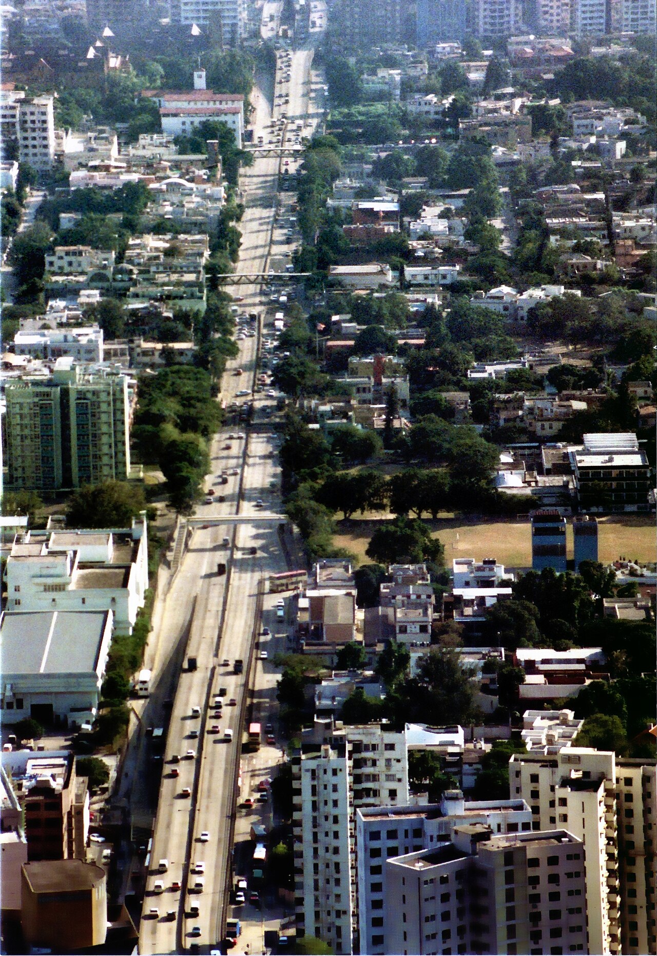
Tai Kok Tsui is an area west of Mong Kok in Yau Tsim Mong district in the Kowloon region of Hong Kong. The mixed land use of industrial and residential is present in the old area. The Cosmopolitan Dock and oil depots were previously located there. Blocks of high-rise residential buildings have been erected on the reclaimed area to the west, which marked the revitalisation of the area with many restaurants and bars setting up shop. Many of the older residential buildings have been vacated and are set to be replaced by high-rise residential and commercial buildings.
- population_in_1860
- 2,000 to 3,000
Verified Timeline
Lore & Background
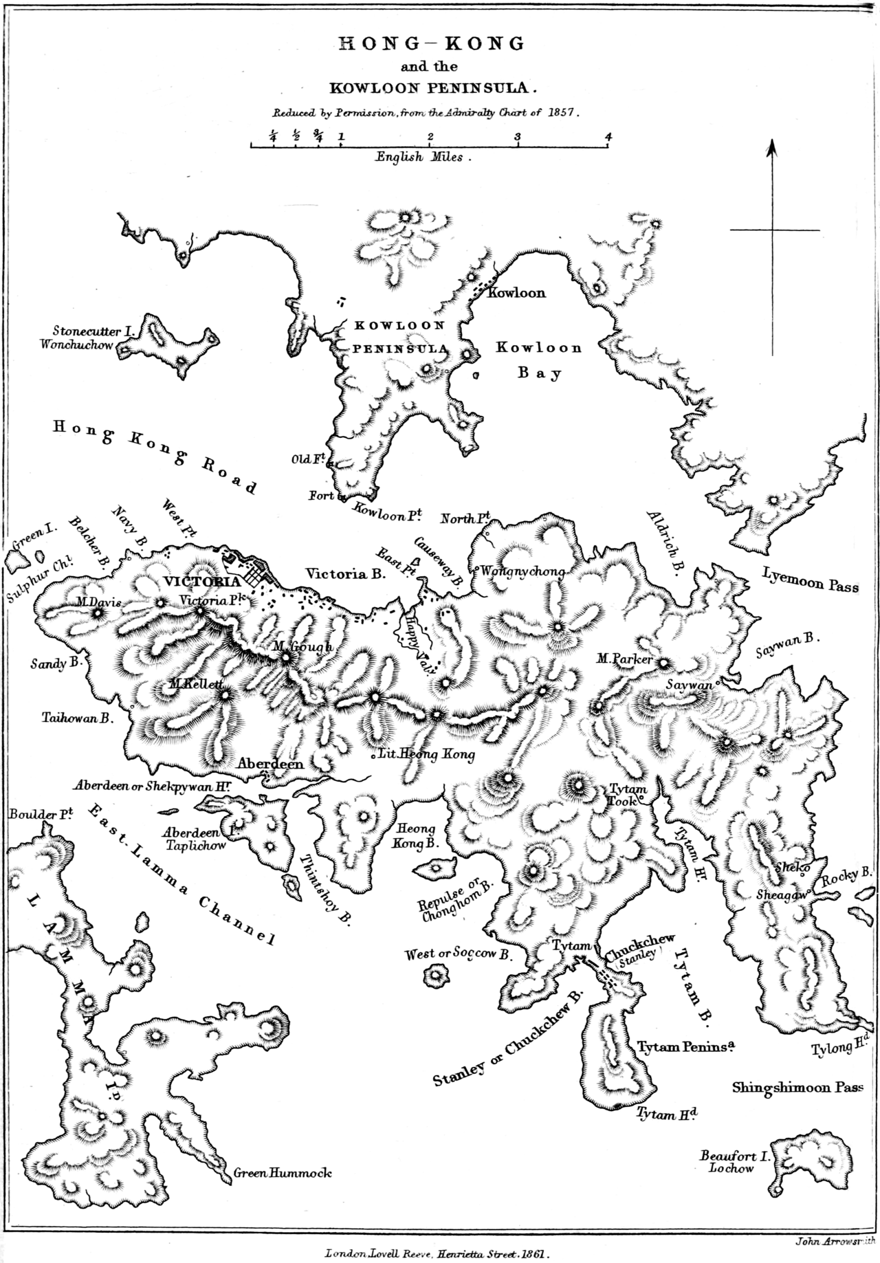
Before any reclamation, Tai Kok Tsui was geographically a long island of Hong Kong of granite linked by an isthmus at its north to Kowloon Peninsula. The long granite hill divided the reclamation in its east and dock area in the west in 1924. The tip of the cape hosted the Asia oil tanks. The area was mainly for dock facilities at this period as reflected in present-day Anchor Street. The Cosmopolitan Dock survived till the 1960s which is now Cosmopolitan Estate. The Guangzhou–Shenzhen–Hong Kong Express Rail Link was built underneath Tai Kok Tsui. In January 2010, the local residents protested and said the railway would cause unbearable noise pollution to residents in some districts and could cause a number of old buildings with poor foundations to collapse. The Office for Safeguarding National Security of the CPG in the HKSAR plans to build its permanent office at Tai Kok Tsui.
Reader's Guide
The Chinese character Tsui (嘴) in Tai Kok Tsui implies that the area was originally an elongated cape on the west side of Kowloon Peninsula. The cove between the cape and Kowloon Peninsula was reclaimed during the period of 1867–1904. More reclamation along its shore took place during the period of 1904–1924 and more covered its tip during the period of 1924–1945. Minor reclamation was needed during the period 1964–1982 when the Tai Kok Tsui Ferry Pier was built. The launch of the Airport Core Programme in the 1990s gave rise to substantial reclamation as well as revitalisation of the district. Part of Tai Kok Tsui - the area newly reclaimed in the 1990s - is increasingly referred to as Olympic due to the nearby MTR station opened in 1998, and the Olympian City shopping centre. Until recently, many of the residents in Tai Kok Tsui were senior citizens but there has been a more recent influx of younger people, especially those returning to Hong Kong after time spent overseas. Traditionally the area has been known as one characterised by the presence of immigrants - often described as 'illegal immigrants' though this term is used rather intolerantly in Hong Kong and at times may describe people who are no such thing.
Did You Know?
- The Chinese character 'Tsui' (嘴) in Tai Kok Tsui means 'mouth' or 'elongated cape', reflecting its original geography as a long granite island linked by an isthmus to Kowloon Peninsula.
- The Cosmopolitan Dock operated until the 1960s and its site is now the Cosmopolitan Estate.
- In January 2010, local residents protested the Guangzhou–Shenzhen–Hong Kong Express Rail Link, warning of unbearable noise and risk of collapse for old buildings with poor foundations.
- The Office for Safeguarding National Security of the CPG in the HKSAR plans to build its permanent office at Tai Kok Tsui.
- Part of Tai Kok Tsui reclaimed in the 1990s is increasingly referred to as 'Olympic' due to the MTR station opened in 1998 and the Olympian City shopping centre.
From Granite Cape to Reclaimed Shore
Tai Kok Tsui's name itself tells a story of geography. The Chinese character "Tsui" (嘴) literally means a mouth or elongated cape, and that is precisely what this stretch of Kowloon Peninsula once was — a long granite island connected to the mainland by a narrow isthmus at its northern end. Over more than a century, that distinctive promontory was gradually swallowed by land reclamation. The cove separating the cape from the peninsula was filled in between 1867 and 1904, followed by further shore reclamation from 1904 to 1924. By the period of 1924 to 1945, even the very tip of the cape had been covered. A smaller round of filling occurred between 1964 and 1982 to make room for the Tai Kok Tsui Ferry Pier. The most dramatic transformation came with the Airport Core Programme in the 1990s, which triggered substantial new reclamation and a full-scale revitalisation. Today, the newly reclaimed western stretch is increasingly known simply as "Olympic," a name borrowed from the nearby MTR station that opened in 1998 and the adjacent Olympian City shopping centre.
Docklands and Oil Tanks
For much of the twentieth century, Tai Kok Tsui was defined by heavy industry rather than homes. The area's western flank, separated from the eastern reclamation by a long granite hill, was dominated by dock facilities — a fact still echoed in the name Anchor Street. The Cosmopolitan Dock was the centrepiece of this maritime economy, operating until the 1960s before the site was redeveloped into what is now the Cosmopolitan Estate. At the very tip of the old cape, the Asia oil tanks stood as a reminder of the area's role in fuel storage. Oil depots and industrial operations gave the neighbourhood a gritty, working-class character that coexisted with the older residential blocks scattered through the district. This mixed-use landscape of warehouses, tank farms, and ageing housing estates persisted for decades. Only the wave of 1990s revitalisation and the subsequent clearance of vacated older buildings began to erase the industrial imprint, replacing it with the glass-and-concrete high-rises that now line the reclaimed waterfront.
The High-Rise Boom
The 1990s reclamation that reshaped Tai Kok Tsui's coastline also set off a construction wave that has continued into the 2010s. Island Harbourview, completed in 1999, was the first private housing estate to rise on the new land, its nine blocks arranged in an L-shape beside Olympian City 1. It was followed by a steady stream of developments: Hampton Place's three blocks in 2003, One Silversea on the former temporary bus terminus site in 2006, and Harbour Green's five towers of 48 to 56 storeys housing 1,514 units in 2007. Shining Heights added a single 348-unit tower in 2009, while Florient Rise, a joint venture between Nan Fung Group and the Urban Renewal Authority, wrapped up in May 2009 with 522 units across three blocks, carefully built around the existing Hoi Ming Court tower that was too new and costly to acquire. The Hermitage, perched above Olympian City 3, added six towers, three of which rank as the 19th tallest buildings in Hong Kong. Together these estates have transformed the reclaimed strip into a dense residential and commercial quarter brimming with restaurants and bars.
A Shifting Community
The human story of Tai Kok Tsui is one of constant demographic turnover. For years the older residential blocks were home largely to senior citizens, giving the neighbourhood a quiet, established feel. The district has long been associated with immigrant communities, a label that in local discourse often carries the loaded phrase "illegal immigrants," a term widely regarded as intolerant and sometimes factually inaccurate. Tensions over development have also shaped community life. In January 2010, residents staged protests against the construction of the Guangzhou–Shenzhen–Hong Kong Express Rail Link beneath their streets, warning of unbearable noise and the risk that vibration could bring down old buildings with weak foundations. More recently, the Office for Safeguarding National Security has announced plans to establish its permanent headquarters in the area, adding a new layer of political significance to a neighbourhood already in the midst of physical reinvention.
Gallery
Frequently Asked Questions
What is Kowloon Peninsula?
Kowloon Peninsula is the southern mainland portion of Hong Kong, sitting directly across Victoria Harbour from Hong Kong Island. It is geographically defined as the stretch of land south of the ridgelines of Beacon Hill, Lion Rock, Tate's Cairn, and Kowloon Peak.
How large is Kowloon Peninsula?
The peninsula encompasses five of Hong Kong's eighteen administrative districts and includes the historic core known as Old Kowloon. Its footprint has grown substantially through multiple phases of land reclamation.
Where is Kowloon Peninsula located?
It forms the southern main landmass of the Hong Kong territory, facing Hong Kong Island across Victoria Harbour. The area is bounded to the north by those four named mountain ranges.
How many people lived on Kowloon Peninsula in the 1860s?
By 1860 the peninsula was home to an estimated two to three thousand residents, a small fraction of the dense population it supports today.
Why is Kowloon Peninsula important to Hong Kong?
As the southern mainland anchor of the territory, it concentrates much of Hong Kong's urban and commercial activity along the Victoria Harbour waterfront. Its successive reclamation projects have made it one of the most intensively developed areas in the region.
More in Peninsulas And Isthmuses 1-24
Spotted an error? Know more?
This is a living reference — every entry is fact-audited, and reader corrections feed straight into our audit queue. Suggest an edit · See this site's audit record