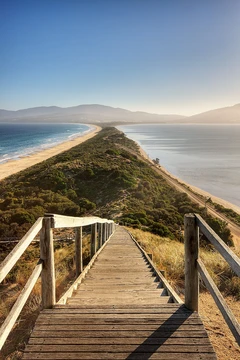
Isthmus of Chignecto
Strategic isthmus linking Nova Scotia to mainland North America.

The Isthmus of Chignecto is a narrow land bridge connecting the Nova Scotia peninsula to mainland North America, bordering the Canadian provinces of New Brunswick and Nova Scotia. Its strategic position has made it a contested and vital transportation corridor since the 17th century, separating the waters of Chignecto Bay from Baie Verte.
- location
- Borders New Brunswick and Nova Scotia, Canada
- width_at_narrowest_point
- 24 kilometres (15 mi)
- separates
- Chignecto Bay (Bay of Fundy) and Baie Verte (Northumberland Strait)
- name_origin
- Mi'kmaq Siknikt, meaning 'drainage place'
- key_feature
- Tantramar Marshes and several prominent ridges
Lore & Background
The isthmus was first settled by French Acadians, who established the farming community of Beaubassin. The Missaquash River was generally accepted as the boundary, though no official border was ever agreed upon. The French used Chignecto as a staging area for raids during King George's War, including the Siege of Annapolis Royal and the Battle of Grand Pre. The isthmus became a key transportation route, with military roads built by French and British colonists. The Trans-Canada Highway was built in the early 1960s, later upgraded to a 4-lane expressway.
Reader's Guide
The Isthmus of Chignecto holds enduring significance as a narrow geographic link that has shaped military, transportation, and political history in the Maritime provinces. Its low elevation and vulnerability to flooding—a 12-metre sea level rise would make Nova Scotia an island—underscore its fragility. The isthmus was the site of early French and British fortifications, reflecting its role as a contested border zone. Later, it became a corridor for railways and highways, including the Intercolonial Railway and Trans-Canada Highway. A proposed Chignecto Canal in the 1950s, intended as a shortcut for ocean-going ships, never advanced beyond surveys. Today, the isthmus faces flooding risks from aging dikes, with a dispute between federal and provincial governments over funding for reinforcement.
Did You Know?
- At its narrowest point between Amherst and Tidnish, the isthmus measures 24 kilometres (15 mi) wide.
- The name Chignecto derives from the Mi'kmaq name Siknikt, meaning 'drainage place'.
- If sea levels were to rise by 12 metres (40 feet), the isthmus would be flooded, making mainland Nova Scotia an island.
- A ship railway project across the isthmus in the 1880s was abandoned shortly before completion.
Frequently Asked Questions
What is the Isthmus of Chignecto?
It is a narrow land bridge roughly 24 kilometres wide at its tightest point that tethers the Nova Scotia peninsula to the rest of continental North America. It sits along the border between New Brunswick and Nova Scotia, Canada.
Where exactly is the Isthmus of Chignecto located?
It stretches between the Canadian provinces of New Brunswick and Nova Scotia, acting as the physical link between the Nova Scotia peninsula and mainland North America. On either side of the strip, it separates Chignecto Bay (part of the Bay of Fundy) from Baie Verte on the Northumberland Strait.
What is the origin of the name 'Chignecto'?
The name derives from the Mi'kmaq word Siknikt, which translates to 'drainage place.' This reflects the region's marshy, water-channelled landscape rather than any European naming tradition.
Why is the Isthmus of Chignecto considered strategically important?
Because it is the sole land connection between Nova Scotia and the continent, it has served as a critical transportation corridor and a contested military position since the 17th century. Controlling the isthmus meant controlling access to the entire peninsula.
What notable natural features can be found on the Isthmus of Chignecto?
The Tantramar Marshes dominate much of the low-lying interior, while several prominent ridges rise above the surrounding wetlands. These features give the isthmus a varied topography despite its overall narrow, flat profile.
More in Peninsulas And Isthmuses 1-24
Spotted an error? Know more?
This is a living reference — every entry is fact-audited, and reader corrections feed straight into our audit queue. Suggest an edit · See this site's audit record